14 Nights - 15 Days
Self-Guided
Western Lycian Way – 15 Day Self-Guided Walking Tour
The Lycian Way runs 760 km along Turkey's southwest coast from Ölüdeniz near Fethiye to Geyikbayırı near Antalya. Waymarked with red-and-white blazes and originally mapped by Kate Clow in 1999, it is Turkey's first designated long-distance trekking route. This page provides a structured breakdown of the full route, sections, distances, elevation profiles, terrain types and seasonal access, based on 18 years of operational guiding on this specific trail.
The 760 km divides logically into three distinct geographic corridors. Most walkers complete one or two of these as a section hike rather than the full route.
This is the most-walked section of the Lycian Way and the most technically varied. The trail begins at Ölüdeniz lagoon, passes through Kayaköy, a abandoned Greek village vacated under the 1923 population exchange, then climbs to Faralya above the Butterfly Valley, descends to Kabak, and continues along exposed coastal ridges to Kalkan and Patara.
Key characteristics of this corridor: persistent elevation change, limestone ridge walking, limited road crossings, good pension network throughout. The Kayaköy–Faralya section has the highest density of waymarks on the entire route. The descent from Faralya to Kabak is 480 m of steep loose limestone, the most technically demanding single descent in this corridor.
Stage highlights: Kayaköy ruins, Butterfly Valley viewpoint above Faralya, Kabak beach, Patara ancient city and 18 km beach.
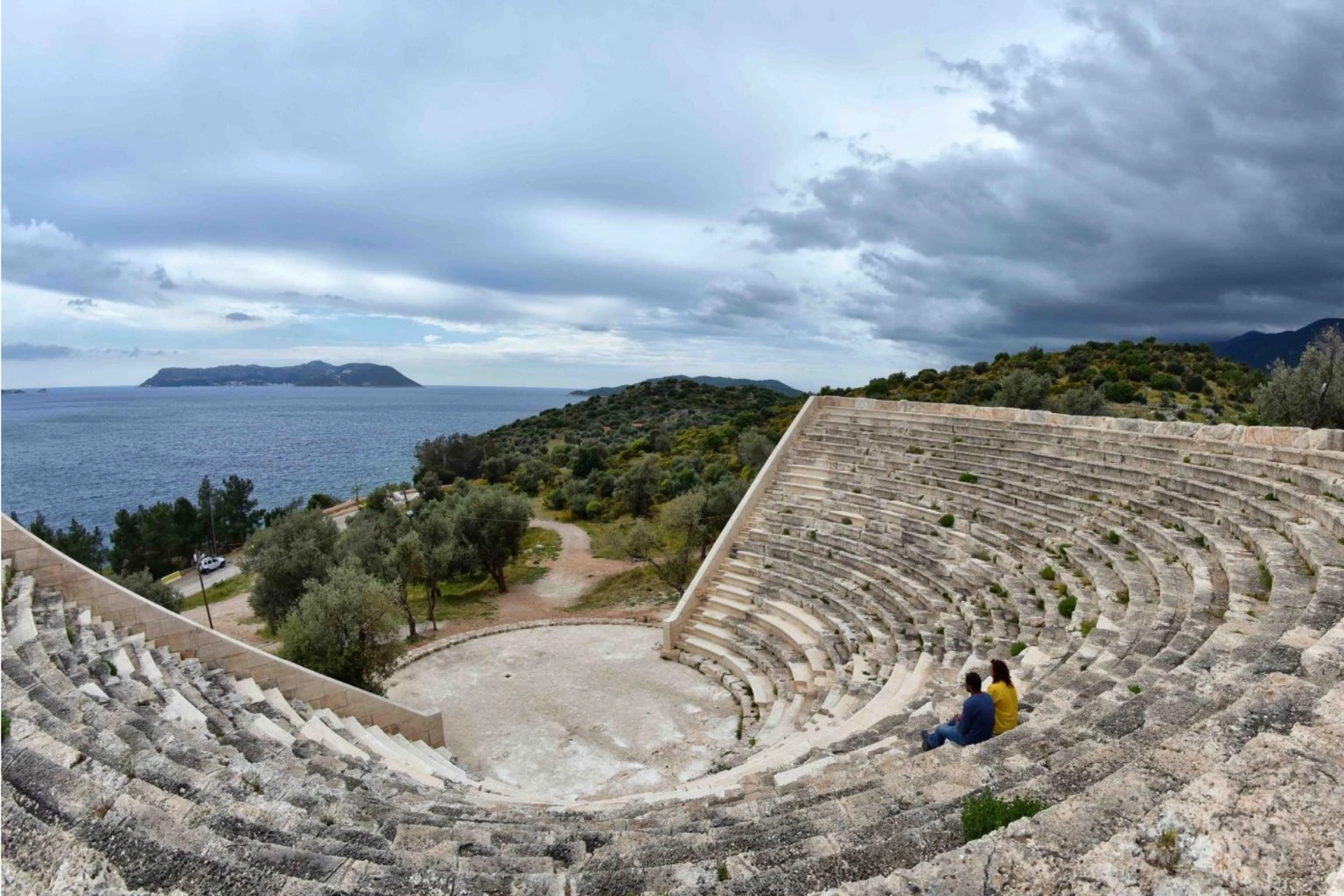
The central corridor is geographically the most dramatic. The trail passes through Kaş, a functioning town with good logistics, then traverses the coast above Kekova, a partially submerged ancient Lycian harbour visible from the trail. The Kekova section is one of the few places on the route where archaeological remains are visible from the path itself without a detour.
The Myra section near Demre contains the most intact rock-cut Lycian tombs on the route, carved directly into vertical cliff faces in the 4th and 5th centuries BC. The trail descends to Demre, the location of the original St Nicholas church.
Stage highlights: Kaş sea views, Kekova sunken city, Aperlae ruins, Myra rock tombs, St Nicholas church Demre.
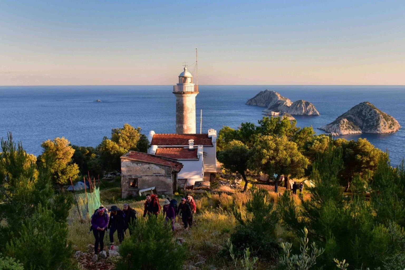
The eastern corridor is the least-walked and the most remote. Olympos is a significant Lycian and Roman site with substantial remains, theatre, baths, ceremonial gates, set in a river valley. Above Olympos, the Chimaera flames burn continuously from the hillside, a methane seep that has been alight since antiquity and was used as a navigation landmark by ancient sailors.
The corridor rises significantly in the Tahtalı Dağı foothills before dropping to the Kemer coast. The final section to Geyikbayırı is inland and forested, ending at a climbing village with daily bus connections to Antalya.
Stage highlights: Olympos ruins, Chimaera eternal flames, Tahtalı Dağı panorama, Phaselis three-harbour ruins, Geyikbayırı climbing village.
The Lycian Way is coastal in location but mountainous in character. The Beydağları system rises sharply from the Mediterranean, there is almost no gradual transition between sea level and ridge. This means daily elevation profiles are not uniform accumulation but repeated steep ascent and descent within the same day.
A typical Lycian Way day: depart coastal village at sea level, climb 700 m on limestone track in 4 km, traverse ridge for 6 km, descend 650 m to next coastal settlement. Total distance 18 km. Total time: 6–8 hours.
Three sections of the route require camping or significantly longer days due to absent village accommodation:
Faralya to Alınca — above Butterfly Valley. No accommodation for approximately 20 km. Wild camping at designated flat sections is standard practice here.
Gömbe to Alakır — inland section north of Kaş. Remote highland terrain, limited water sources. Requires full camping kit and water carry.
Tahtalı section above Olympos — highest elevation on the route, reaching approximately 1,500 m. Snow possible October through April.
Outside these three sections, pension or village house accommodation is available every night.
The Lycian Way accumulates more total elevation than the Camino Francés over a comparable number of days, with significantly more heat exposure than Tour du Mont Blanc. The technical difficulty is below GR20 — there is no scrambling on fixed cables — but the descent gradient on limestone is comparable, and the thermal load in late spring and autumn is substantially higher than alpine routes.
Approximately 30% of the route follows original Roman paved roads. These are angular limestone slabs, often intact, set on a raised causeway. They are hard underfoot, transfer impact directly to joints, and become slippery when wet. Trekking poles reduce fatigue significantly on Roman road sections.
The majority of the remaining route follows shepherd and mule paths — compacted earth, loose gravel on descents, exposed root sections in forested areas. These sections are generally easier on joints than Roman road but require more navigation attention.
Waymark quality varies significantly. The western corridor from Ölüdeniz to Patara has the most consistent marking — blazes every 100–200 m on most sections. The central and eastern corridors have longer gaps and more intersecting shepherd paths that are not marked. A downloaded GPX track is operationally necessary for independent walkers on the central and eastern sections, not optional.
The Lycian Way's strength as a sectional route is that coastal towns with bus connections punctuate the route regularly.
This structure means a 5-day or 7-day section can be started and ended at transport-accessible points without a support vehicle.
Not all sections are equally accessible in all seasons. The following is based on operational experience, not theoretical analysis.
June through August across all sections: temperatures regularly exceed 35°C on exposed ridge sections. The primary medical risk is heat illness, not injury. Three to four litres of water carry per person is the minimum for summer hiking — not a recommendation, a baseline.
The Lycian Way intersects or connects to several secondary networks visible on current mapping:
St Nicholas Ways — Byzantine monastery paths above Demre connecting to the Lycian Way. Named for the historical St Nicholas, Bishop of Myra. These paths pass several upland monastery ruins and are substantially less-walked than the main route.
Kemer Municipal Trails — Maintained by Kemer Municipality, these connect to the eastern Lycian Way and extend the network into the Tahtalı foothills. Marked in yellow-red.
Konyaaltı Municipal Trails — Western approach to Antalya, connecting to the Geyikbayırı terminus area.
Proposed St Paul Trail Link — A projected corridor would connect the Lycian Way eastern end to the St Paul Trail at Perge. Not yet completed, but partial sections are walkable.
All intersecting networks appear on OpenStreetMap. Where they overlap with Lycian Way waymarks, navigation requires careful attention — marker colours differ but physical path may be identical for several kilometres.
Water availability is the primary logistical variable on the Lycian Way. Sources marked on published maps are not always reliable — springs run low or dry in summer, village fountains are sometimes decommissioned.
Reliable year-round sources exist at most village pensions, at the Faralya and Kabak settlements, and at the Myra and Olympos sites. Between villages on ridge sections, carry capacity is the determining factor. For the three high-level camping sections, minimum 3L carry from last confirmed source. Maximum carry weight of water is a real planning variable — 3 litres adds 3 kg.
The primary medical risk on the Lycian Way is not altitude, not technical terrain — it is heat illness on exposed sections in warm months. Symptoms of heat exhaustion on a ridge section 8 km from the nearest road present a serious evacuation problem. The mitigation is behavioural: early starts (on trail by 07:00 in summer), shade rests between 11:00 and 14:00, electrolyte supplementation, minimum 3–4L water carry.
The second risk category is navigation error leading to extended exposure. On the western corridor this risk is low — waymarks are consistent. On the central and eastern corridors, waymark gaps of 30+ minutes are possible. A downloaded GPX track on an offline-capable device with a spare power bank eliminates this risk category almost entirely.
Roman road descents concentrate impact on knee cartilage and ankle ligaments. The Faralya descent, the Kabak approach, and several sections above Kaş are the highest-injury sections on the route. Trekking poles reduce knee load by approximately 25% on descents. Anyone with pre-existing knee issues should treat these sections as a separate planning variable.
The decision is logistical, not a reflection of confidence. Even experienced long-distance walkers underestimate the navigation complexity of the central corridor.
Lycian Walk provides guided support for all three corridors, with full luggage transfer and accommodation pre-arranged. Self-guided walkers can access GPS track packages and accommodation-only booking through our Lycian Way tours page.
The Lycian Way is approximately 760 km from Ölüdeniz near Fethiye to Geyikbayırı near Antalya. This covers roughly 35 walking days at a moderate pace of 15–22 km per day. Most walkers complete the route in sections over multiple trips rather than as a single continuous traverse.
The three high-level sections requiring camping — Faralya to Alınca, Gömbe to Alakır, and the Tahtalı section above Olympos — are the most logistically demanding. For day-stage difficulty, the descent from Faralya to Kabak (480 m on loose limestone) and the exposed ridge sections above Kaş in summer heat are consistently the hardest single stages for guided groups.
Not for the western corridor from Ölüdeniz to Patara, which has consistent waymarking and a well-developed pension network. For the central and eastern corridors, professional guidance is operationally useful — waymark gaps are longer, villages are more remote, and logistics require Turkish communication. A downloaded GPX track is the minimum navigation requirement for any independent walker.
For a 5–7 day section, the western corridor starting from Kayaköy or Ölüdeniz is the most accessible and logistically straightforward. It connects Dalaman Airport to the trailhead in under two hours and ends at Kalkan or Patara, from where buses return to Fethiye. This section covers approximately 80–100 km depending on route variant.
GPX tracks for all sections of the Lycian Way are available on Wikiloc, Komoot and AllTrails. Quality varies between uploaded tracks — some follow road shortcuts rather than the original footpath. For critical sections, cross-reference two sources. Lycian Walk clients on self-guided tours receive verified GPS tracks for their specific itinerary sections.
The western corridor is accessible to walkers with moderate fitness who train adequately beforehand. The daily elevation gain of 600–900 m requires specific preparation — flatland walking does not prepare knees for limestone descents. Anyone attempting the central or eastern corridors without prior long-distance trekking experience should do so with a guide or after completing the western section first.
Except for three high-level sections requiring camping, village pensions and small guesthouses are available every night on the western and central corridors. Most are family-run with meals included. Advance booking is necessary in April, May and October — the peak walking months. Wild camping is practised and generally tolerated on ridge sections, but water access must be planned independently.
The Lycian Way map represents a 760 km traverse through three distinct geographic and historical corridors — western coastal, central archaeological, and eastern forested. The route is walkable in full over 30–35 days or in sections of 5–14 days using the transport-accessible entry and exit points along the coast.
The physical demands are real and should not be underestimated: daily elevation gain comparable to alpine routes, heat exposure that has no equivalent in northern European trekking, and navigation complexity that increases substantially east of Patara.
Plan with accurate data, carry more water than you think you need above village level, and treat the three high-level sections as separate logistical problems. The rest of the route is manageable with appropriate preparation.
Explore guided and self-guided Lycian Way tours at lycianwalk.com/category/lycian-way
Send us a message
For questions, custom tours, or travel planning help, contact us. Our team will reply shortly.